
When I was growing up, our next-door neighbour was a cartographer at Ordnance Survey, the official mapmakers of Great Britain. He sported a splendid beard, had a fondness for tweed, and buzzed around town in a bright orange Mini.
When I meet Manish Jethwa, two years into his role as CTO at this great British institution, he strikes me as a very different kind of OS figure, someone who embodies a new era for the organisation. “I’ve just taken my tweed jacket off!” he laughs.
Despite the contrast, Jethwa feels like a natural fit for an organisation with more than two centuries of mapmaking history, now driven by a mission to “deliver better data to more destinations.”
He has spent most of his career in the geospatial realm, beginning with a PhD at MIT on the “City Scanning Project,” which used street-level images tied to GPS and orientation data to build 3D models of entire cities.
That early work set the tone for a career in computer vision, machine learning and infrastructure asset management – where OS’s flagship MasterMap kept reappearing as the essential reference point. “So, when the chance came to join the team that looks after the foundational dataset itself,” he says, “it felt like the natural next step. The overlap between what I’d been doing for the past 20 years, and OS’s ambitions made it a no-brainer.”
In his current role, Jethwa oversees everything from the systems that underpin OS’s data to cyber security, user experience, research and AI teams. He stepped into the role just as generative AI and machine learning began to transform not only how maps are made, but how we interact with them.
Back on the map
“GPS revolutionised mapping because it changed how we locate and record assets,” Jethwa explains. “But it still depended on people physically measuring things on the ground.”
Today, that model has been replaced by an “imagery-first” approach, where data is extracted directly from satellites or aerial surveys. The result is a far more accurate picture of the world – a critical foundation for modern mapping.
At the same time, maps themselves have evolved. Instead of a single, universal product like MasterMap, OS now produces multiple, theme-specific datasets covering everything from transport networks to the natural environment. That richness brings depth but also complexity, making it hard for non-specialists to see how everything connects. Here, AI is beginning to make a real difference. Generative AI, for instance, can translate complex geospatial data into plain language.
“You can now ask a question like, ‘Where are great places to exercise near me?’ and the system can draw on datasets covering leisure centres, parks or skate facilities,” Jethwa says.
“That kind of interaction just wasn’t possible a few years ago. AI is democratising access to geospatial information, making it more intuitive and accessible for everyone.”
One of the most practical uses of AI at OS is feature extraction. “Take roofs as an example,” Jethwa explains. “We use machine learning to identify the material, and computer vision techniques to determine the aspect, direction and orientation. Put those together and you can calculate the solar potential of a house, hugely valuable in the context of the green agenda.”
Guarding centuries’ worth of trust
But these techniques bring challenges. The CTO points out that roofs made of plastic can look like slate, and models can be fooled as easily as humans. “The trust people place in OS data has been built over two centuries,” Jethwa says. “As we adopt new techniques, we must make sure they’re robust enough to stand the test of time. We’re not just building for today, but for the next decade or more.”
That principle also guides OS’s experiments with agentic AI. As the organisation works to make its data hub simpler and more intuitive, Jethwa sees potential in deploying agents to sit between developers and OS’s APIs, helping to automate how customers access and use data.
Yet this innovation comes with a security dilemma. “Traditionally, our firewalls can distinguish between human users, service accounts and malicious actors,” he explains.
“With agentic AI, it’s much harder to tell if an automated request is legitimate or malicious. And because agents need broad access to be useful, the threat surface grows.” For an organisation whose datasets support emergency services and critical infrastructure, protecting against disruption is non-negotiable.
It’s one of the reasons Jethwa has been closely involved in shaping OS’s Responsible AI Charter, based on the Locus Charter, an international framework for the ethical use of location data.
“With the amount of data, we’re collecting, and our ambitions around AI, it’s essential we use it responsibly,” he says. That means checking for bias in training data, for instance, ensuring a balance of urban and rural imagery, and representing both affluent and deprived areas. “We want to make sure the models we build serve the whole country fairly.”
Find the right path
On large language models, he is equally pragmatic. “From a sustainability point of view, we’re not training them from scratch,” he says. Instead, OS fine-tunes commercially available models such as GPT, accessed through Microsoft’s Azure platform.
The focus is on training models with internal documentation so they can bridge the gap between plain-English questions and technical specifications. “It’s really about creating an interface,” he explains, “so someone can ask a question in everyday language and get it translated into the technical detail they need.”
Given so much of OS’s work is now digital rather than physical, I ask Jethwa whether the type of person working there has changed much since the days of my old neighbour – the bearded cartographer in tweed with the orange Mini. “It’s certainly evolved,” he admits.
Taylor Wimpey reconstructs homebuilding with AI
For an organisation more than 230 years old, long careers are still common: OS regularly celebrates people who’ve spent 40-plus years at the organisation, carrying invaluable expertise and institutional knowledge. But alongside that heritage, the organisation has been bringing in talent in areas like AI, computer vision and large-scale data management.
“We’ve got the full gamut,” he says, “from cartographers and geodetics experts [a blend of maths and geography that’s sadly becoming a dying field] through to specialists in cutting-edge technology.”
For Jethwa, the bigger shift has been cultural. Traditionally, OS delivered projects in a very structured, waterfall style: define the requirements, build, deliver, sometimes years later. But in a world where data changes constantly, that model no longer works.
“We’ve had to move from a project mindset to a product mindset,” he says. That means developing systems and datasets more agilely, testing them earlier, even if they’re incomplete, and refining them over time. “It’s a huge mindset change, but it’s essential if we want to keep up with the pace of change, while protecting the trust people place in OS data.”
Trusted framework
So, who uses OS data? “The short answer is almost everyone,” explains Jethwa. Public sector organisations get free access, but the reach extends far beyond government. Utility companies, infrastructure providers, food delivery and ride-hailing apps all rely on OS address data to ensure orders arrive at the right doorstep.
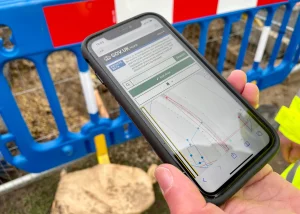
OS now produces theme-specific datasets covering everything from transport networks to the natural environment
Even Apple and Google feed OS information into their services. “There’s a stat we often share,” Jethwa notes, “that the average person in the UK touches OS data around 42 times a day.” What makes OS unique, he argues, is that its datasets act as connective tissue for the nation, a trusted framework of streets and properties that underpins everything else.
That foundation makes OS data especially valuable to enterprises. Almost every organisation is generating its own datasets, but the real value comes from linking them back to location. “If you’re in construction, you might want to tie project details to a site; if you’re a financier, you may want to link loans to specific properties. Location is the fabric that binds it all together and that’s what OS provides.”
Companies can also tap into datasets covering the built and natural environment, transport networks and routing. With the rise of generative AI, OS is developing assistants to help businesses navigate these datasets more easily, turning what could be a challenge into an opportunity.
How does OS fit into a world dominated by Google Maps? Jethwa sees it as collaboration, not competition. “If you’re heading outdoors to climb Snowdon, chances are you’ll turn to OS for authoritative mapping. But if you’re ordering a burger, you want Google Maps to get the driver to your door. It’s all part of one ecosystem.”
That ecosystem, he adds, works best when everyone shares a consistent source of truth. “We don’t want different versions of reality when it comes to delivering your post or your dinner. Our role is to provide the trusted framework that others can build on, and, unlike some global tech companies, we don’t have any ulterior motive beyond delivering social good for Great Britain.”
Partnerships are key to that ecosystem. OS works with universities and research institutes to ensure it stays at the cutting edge of data science and AI, while also supporting startups through initiatives like Geovation, its London-based accelerator for geospatial and property-tech ventures. “We see ourselves as a convener,” says Jethwa. “Internationally, OS is regarded as a beacon for how geospatial data can be extracted, managed and shared. Whether it’s through research collaborations or helping seed the next generation of geospatial businesses, being part of that wider community is central to what we do.”
CTO Takeaways
– Trust is the ultimate asset. Jethwa stresses that OS’s reputation, built over two centuries, is what allows it to adopt AI without losing credibility. For any sector, trust in data quality and reliability is non-negotiable
– Shift from projects to products. Moving from long, rigid project cycles to agile, product-led development is critical when information and customer needs evolve rapidly
– Build responsibly from the start. The Responsible AI Charter shows the importance of embedding fairness, transparency, and bias-checking at the foundation, not as an afterthought
– Balance automation with human oversight. The “human-in-the-loop” approach ensures that AI systems are monitored, validated, and continuously improved – a principle any data-driven business can adopt.
– Think ecosystem, not competition. By seeing Google and Apple as partners rather than rivals, OS shows how collaboration can extend impact and relevance, even in highly competitive environments.